
-
Sylvhia

 .
.User deleted
Salar de Uyuni The World's Largest Salt Flat - Bolivia
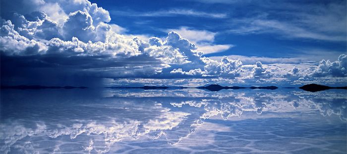
Salar de Uyuni is part of the Altiplano of Bolivia in South America and it is the world's largest salt flat at 10,582 square kilometers (4,086 sq mi). It is located in the Potosí and Oruro departments in southwest Bolivia, near the crest of the Andes and is at an elevation of 3,656 meters (11,995 ft) above mean sea level. The Altiplano is a high plateau, which was formed during uplift of the Andes mountains. The plateau includes fresh and saltwater lakes as well as salt flats and is surrounded by mountains with no drainage outlets.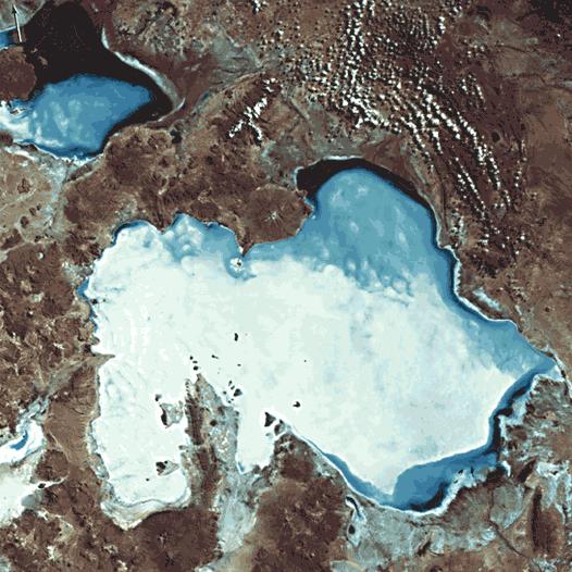
"Uyuni landsat". Licensed under Public domain via Wikimedia Commons.
The geological history of the Salar is associated with a sequential transformation between several vast lakes. Some 30,000 to 42,000 years ago, the area was part of a giant prehistoric lake, Lake Minchin. Its age was estimated from radiocarbon dating of shells from outcropping sediments and carbonate reefs and varies between reported studies. Lake Minchin (named after Juan B. Minchin of Oruro) later transformed into paleolake Tauca having a maximal depth of 140 meters (460 ft), and an estimated age of 13,000 to 18,000 or 14,900 to 26,100 years, depending on the source. The youngest prehistoric lake was Coipasa, which was radiocarbon dated to 11,500 to 13,400 years ago. When it dried, it left behind two modern lakes, Poopó Lake and Uru Uru Lake, and two major salt deserts, Salar de Coipasa and the larger Salar de Uyuni. Salar de Uyuni spreads over 10,582 square kilometers (4,086 sq mi), which is roughly 100 times the size of the Bonneville Salt Flats in the United States. Lake Poopó is a neighbor of the much larger Lake Titicaca. During the wet season, Titicaca overflows and discharges into Poopó, which, in turn, floods Salar De Coipasa and Salar de Uyuni.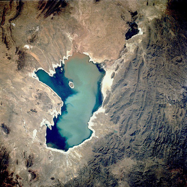
"Poopo 1991". Licensed under Public domain via Wikimedia Commons.( Poopó Lake )
"Lago Uru Uru Bolivia Satellite map 67.09971W 18" by NASA - Nasa WorldWind. Licensed under Public domain via Wikimedia Commons.(Uru Uru Lake)
Lacustrine mud that is interbedded with salt and saturated with brine underlies the surface of Salar de Uyuni. The brine is a saturated solution of sodium chloride, lithium chloride and magnesium chloride in water. It is covered with a solid salt crust varying in thickness between tens of centimeters and a few meters. The center of the Salar contains a few "islands", the remains of the tops of ancient volcanoes submerged during the era of Lake Minchin. They include unusual and fragile coral-like structures and deposits that often consist of fossils and algae.
The area has a relatively stable average temperature with a peak at 21 °C (70 °F) in November to January and a low of 13 °C (55 °F) in June. The nights are cold all through the year, with temperatures between −9 and 5 °C (16 and 41 °F). The relative humidity is rather low and constant throughout the year at 30 to 45%. The rainfall is also low at 1 to 3 millimeters (0.039 to 0.118 in) per month between April and November, but it may increase up to 70 millimeters (2.8 in) in January. However, except for January, even in the rainy season the number of rainy days is fewer than 5 per month.
Salar is salt flat in Spanish. Uyuni originates from the Aymara language and means a pen (enclosure); Uyuni is also the name of a town that serves as a gateway for tourists visiting the Salar
Aymara legend tells that the mountains Tunupa, Kusku and Kusina, which surround the Salar, were giant people. Tunupa married Kusku, but Kusku ran away from her with Kusina. Grieving Tunupa started to cry while breast-feeding her son. Her tears mixed with milk and formed the Salar. Many locals consider the Tunupa an important deity and say that the place should be called Salar de Tunupa rather than Salar de Uyuni.Isla Incahuasi

It is a hilly and rocky outcrop of land and former island in Bolivia situated in the middle of Salar de Uyuni
Incahuasi has a total area of 24.62 hectares (61 acres) and hosts gigantic cacti (Trichocereus pasacana) and a tourist center. There are unusual and fragile coral-like structures and deposits that often consist of fossils and algae. The place is the top of the remains of an ancient volcano, which was submerged when the area was part of a giant prehistoric lake, roughly 40,000 years ago.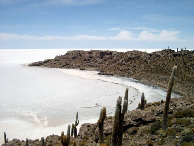
Isla del Pescado

"Isla de Pescado Bolivia Salar de UyuniCrop" by Isla_de_Pescado_Bolivia_Salar_de_Uyuni.jpg: Entropy1963
derivative work: Materialscientist (talk) - Isla_de_Pescado_Bolivia_Salar_de_Uyuni.jpg. Licensed under Public domain via Wikimedia Commons.
The local guides claim that the place took its name Isla del Pescado ("Island of the Fish") because when viewed from the distance it looks like a fish
http://en.wikipedia.org/wiki/Salar_de_Uyuni .
.
Salar de Uyuni The World's Largest Salt Flat - Bolivia |


